
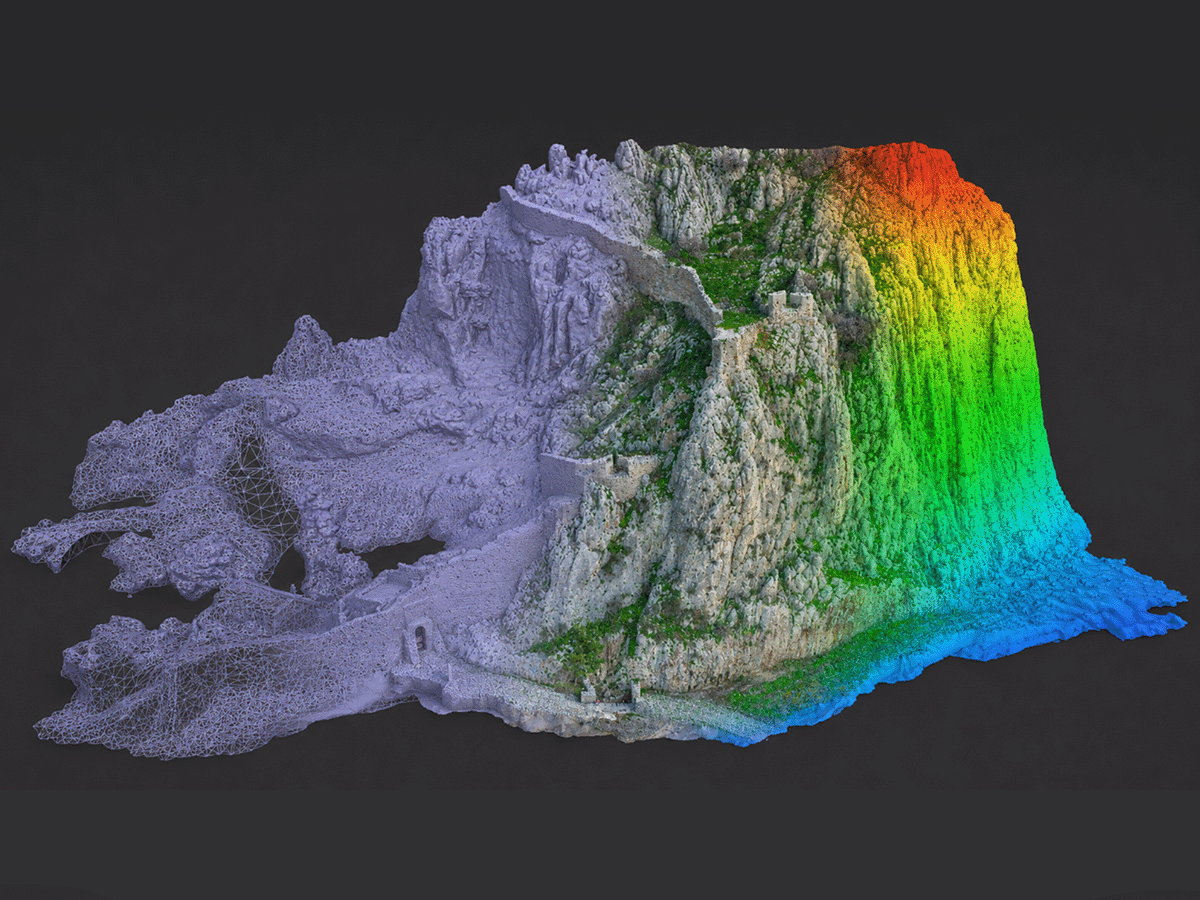
Reality Modeling at Acrocorinth: Supporting Safety for a Major International Film Production
At the entrance of the Castle of Acrocorinth, one of the most iconic and technically demanding historic sites in the Peloponnese, history, landscape, and advanced geospatial technology came together for a very specific purpose: to support the technical assessment and safety planning of a highly sensitive location.
ARGO-E GROUP contributed to the project by providing reality modeling and UAV-based geospatial surveying services for the rocky slopes at the entrance of the Castle of Acrocorinth, on behalf of the GEOCON Consulting company, which was responsible for preparing the study to address possible rockfalls. The work was carried out during the pre-production phase of a major international feature film production, in relation to the safety of the production crews and actors who would later film scenes in this unique and challenging environment.
The project demonstrates how reality modeling can support critical decision-making in real-world conditions, especially in areas where safety, accessibility, cultural heritage, and operational requirements must be addressed with accuracy and responsibility.
From Field Survey to Technical Decision Support
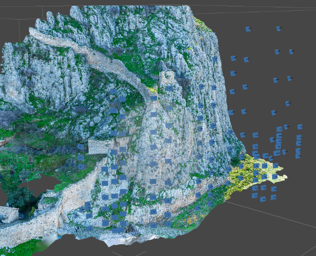
The scope of ARGO-E GROUP's work focused on accurate documentation of the rocky slopes at the entrance of the Castle, using UAV technology and photogrammetric workflows. The objective was to create a reliable geometric and visual basis for the preparation of a technical report addressing potential rockfall hazards.
The deliverables included a complete set of geospatial and technical documentation, suitable for further engineering assessment and study:
- site plan and orthophoto map,
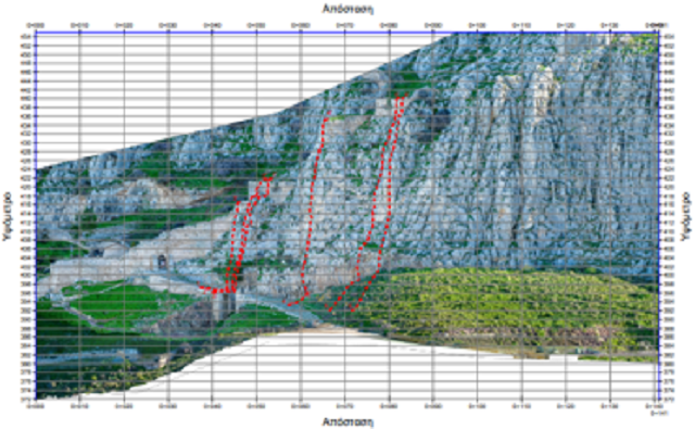
- elevation drawing of the rocky slopes,
- cross-section drawings,
- photographic documentation,
- point cloud of the surveyed area.
This type of documentation enables engineers and specialists to examine the morphology of the rock slopes, assess geometric conditions, identify critical features, and better understand the relationship between the natural terrain and the safe movement of people and equipment in the area.
 |
 |
|
Reality Modeling for Safety, Prevention, and Technical Documentation
The value of reality modeling extends far beyond the creation of visually impressive 3D models. Its true strength lies in transforming a complex physical environment into a measurable, analyzable, and technically reliable digital dataset.
In locations such as Acrocorinth, where steep rocky terrain, historical significance, and public-access considerations coexist, accurate 3D documentation becomes a critical tool. It allows technical teams to evaluate the site with greater confidence, reducing uncertainty and supporting well-informed decisions.
In this case, the geospatial survey and reality modeling deliverables supported the technical assessment of the rocky slopes at the Castle entrance, within a context where the safety of production crews, technical teams, actors, and all personnel involved was of central importance.
A Project with a Unique Story
The connection of this work with the pre-production phase of a high-profile international cinematic production gives the project a special significance. A major international film production selected Greek landscapes of exceptional historical and cultural value, highlighting not only the country's cinematic potential but also the need for precise technical support behind the scenes.
For ARGO-E GROUP, this project is a strong example of how advanced geospatial technologies can be applied in demanding environments where speed, accuracy, and reliable deliverables are essential.
From infrastructure and cultural heritage sites to tourism developments, industrial facilities, natural slopes, and film production environments, reality modeling provides a powerful technical foundation. It allows stakeholders not only to visualize a site, but also to measure it, analyze it, and plan interventions or operations with greater safety and confidence.
Acknowledgements
We would like to express our sincere thanks to Dr. Charis Saroglou of the National Technical University of Athens for his trust, collaboration, and valuable contribution to the technical aspects of the project. His scientific guidance and preparation of the technical report for the mitigation of rockfall hazards at the rocky slopes near the entrance of the Castle of Acrocorinth were essential to the overall technical approach.
Technology in the Service of Safety and Experience
The Acrocorinth project clearly demonstrates that modern geospatial technologies are not merely tools for documentation. They are tools for prevention, planning, and evidence-based decision-making.
At ARGO-E GROUP, every reality modeling project is an opportunity to bridge the physical and digital worlds, providing engineers, public authorities, private clients, production teams, and infrastructure owners with the information they need to act with accuracy, safety, and confidence.
Acrocorinth, with its remarkable history and dramatic landscape, provided the ideal setting to showcase this value: technology serving people, safety, and the responsible use of a place of exceptional importance.