-
 ENERGY INFRASTRUCTURE DEVELOPMENT
Visual Documentation for Energy Infrastructure and Development Projects
At ARGO-E we support energy companies and investors by transforming their projects into clear and well-documented visual representations . Through photorealistic renderings and visual impact studies, we make a substantial contribution to the environmental permitting of Renewable Energy Source (RES) projects and extractive activities. Our goal is technical accuracy, regulatory compliance, and constructive communication with the competent authorities and the public.
Why It Matters
Requirement for environmental permitting:
In RES and extractive activity projects, visual documentation is a fundamental and mandatory component of the Environmental Impact Assessment (EIA). Reality Modeling ensures that these requirements are met in a technically sound and fully documented manner.
Reliable representation of the project in the landscape:
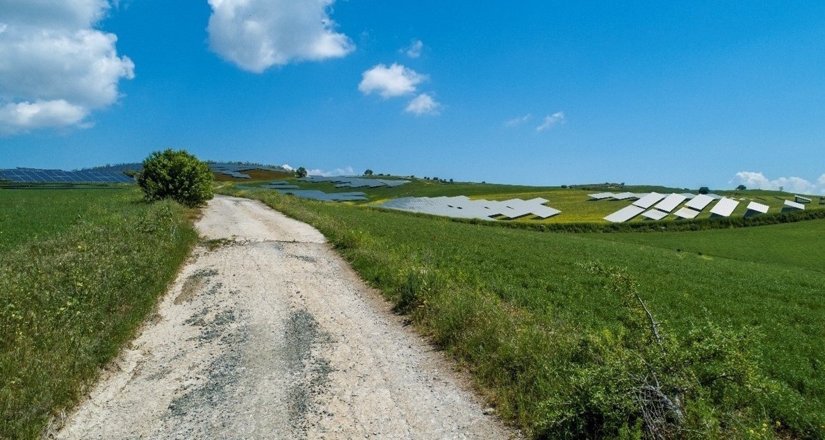
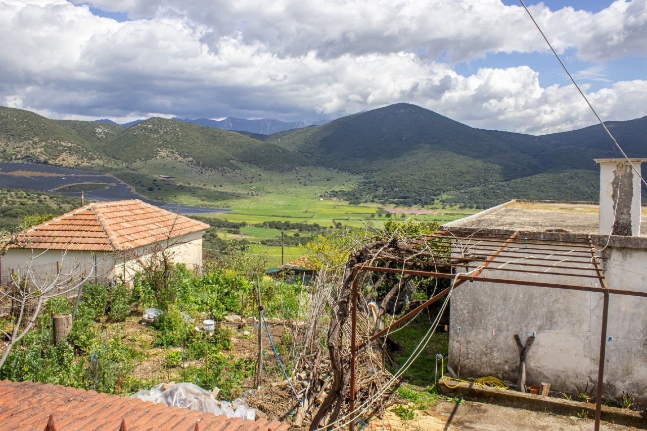
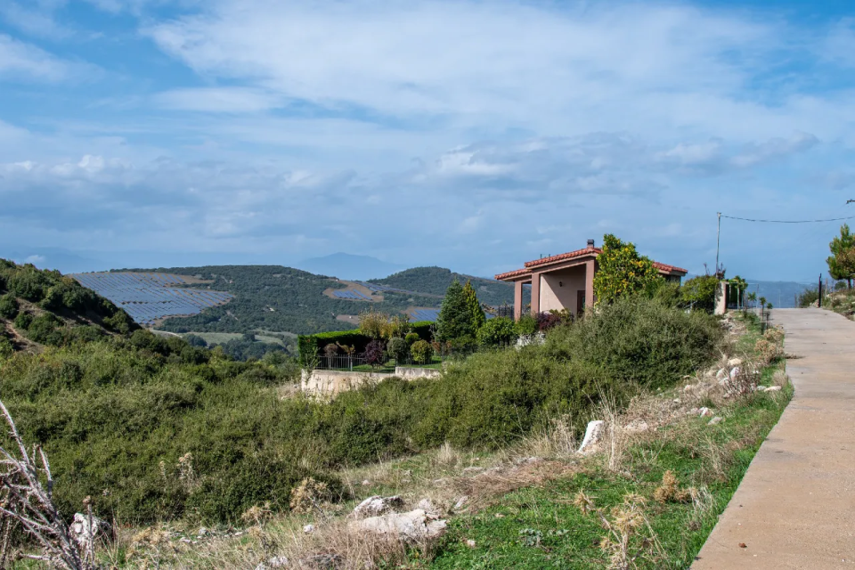
Through high-accuracy terrain models and photorealistic renderings, the project is depicted as it will actually appear after construction. This enables a substantive assessment of visual impact, visibility, and integration into the landscape.
Risk reduction and timely optimizations:
Early visualization highlights critical viewpoints and sensitive areas, allowing design adjustments before the EIA submission. This reduces objections, delays, and investment risk.
Effective communication with competent authorities and the public:
Photorealistic renderings transform technical information into comprehensible visual content, facilitating public consultation and enhancing the transparency and acceptance of the project.
Our Services Include
Photorealistic
Renderings
We produce high-quality renderings of energy and extractive projects, fully integrated into the real landscape, with accuracy in scale, lighting, and materials.
Visual Impact Assessment Studies
We undertake visual impact studies within the framework of EIAs, including viewpoint
selection, visibility analyses, worst-case scenarios, and mitigation proposals.
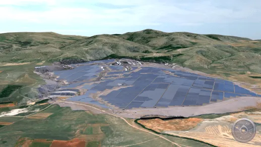
Landscape & Visibility Analysis
Based on digital terrain models (DSM/DTM), we assess the visibility of the project from
critical locations, providing both quantitative and qualitative conclusions.
Before–After & Rehabilitation Scenarios
We visualize the operational phase of the project and rehabilitation scenarios,
enhancing its transparency and acceptance.
If you are planning a new energy or extractive project and need documented visual studies for permitting or investment presentation, do not hesitate to contact us.
View our portfolio featuring related applications


